 Kilimanjaro Climbing Tours
Mount Kilimanjaro Height: Every Measured Figure, From the Gates to Uhuru Peak
The Mount Kilimanjaro height question has a short answer and a long one. The short answer is 5,895 m (19,341 ft) at Uhuru Peak, the summit on the Kibo cone. The long one involves four surveys that disagree by a few metres, two extinct sister cones, gates that start as low as 1,600 m, and a shrinking ice cap near the top. This page collects every published figure in one place, says who measured it, and shows how high you actually sleep and walk on a climb of Mount Kilimanjaro. The bookable trips are compared on all Kilimanjaro climbing tours.
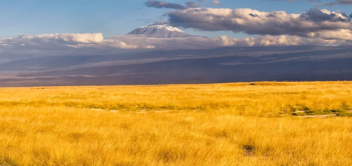
Kibo above the plains. Photo: Ray in Manila, CC BY 2.0, via Wikimedia Commons
Quick answer The height in one line
Mount Kilimanjaro is 5,895 m (19,341 ft) high at Uhuru Peak, the summit of the Kibo cone. That figure comes from a 1952 British survey and is the one used by Tanzania National Parks Authority and UNESCO. Later measurements gave 5,892 m in 1999, 5,902 m in 2008 and 5,899 m in 2014. Kilimanjaro has a topographic prominence of 5,895 m and an isolation of 5,510 km, both ranked 4th in the world.
Key takeaways
- The summit itself has its own page: read about Uhuru Peak before you go.
- Every route reaches the same 5,895 m, and the 7-day Lemosho Route 7 Days is a private 7-day climb to it.
- See how each path up the mountain differs in the routes compared on the Kilimanjaro climbing tours homepage.
- The camps and gates that shape the climb are laid out in the section below on how high you sleep on the way up.
Every Measured Height
Kilimanjaro has been measured several times and the answers differ by a few metres.
The Surveys Side by Side
The 5,895 m figure comes from a 1952 British survey. Tanzania National Parks Authority and UNESCO both use it, and Wikipedia cites both. Later measurements have produced slightly different numbers. None of the later surveys has replaced the 1952 figure in official use, so 5,895 m (19,341 ft) remains the number to quote. The table gathers the four published measurements with their years and sources.
For planning purposes the difference does not matter. The climb is the same walk whichever survey you believe.
| Year | Height | Source |
|---|---|---|
| 1952 | 5,895 m (19,341 ft) | British survey, used by TANAPA and UNESCO, cited by Wikipedia |
| 1999 | 5,892 m | Later measurement, cited by Wikipedia |
| 2008 | 5,902 m | Later measurement, cited by Wikipedia |
| 2014 | 5,899 m | Later measurement, cited by Wikipedia |
Why the Figures Differ
The published figures do not say why the readings differ. The 1999 reading is the lowest at 5,892 m and the 2008 reading the highest at 5,902 m. TANAPA and UNESCO still use 5,895 m (19,341 ft).
Three Volcanoes in One Mountain
Kilimanjaro is a large dormant stratovolcano built from three separate volcanic cones.
Kibo, Mawenzi and Shira
Kibo is the highest cone and the one every climber visits. Its rim holds Uhuru Peak at 5,895 m (19,341 ft). Mawenzi stands at 5,149 m (16,893 ft) and Shira at 4,005 m (13,140 ft), and both are extinct. Kibo is dormant rather than extinct, and it last erupted about 150,000 to 200,000 years ago. Wikipedia says Shira began erupting about 2.4 million years ago and Mawenzi and Kibo about 1 million years ago, and that more than 250 parasitic cones formed around Kibo between 150,000 and 200,000 years ago.
The three cones give the mountain its great bulk. Kibo is more than 24 km wide at the Saddle altitude and its southern escarpments stand 180 to 200 m high. The Saddle between Kibo and Mawenzi is a plateau at about 4,400 m (14,400 ft), about 5 km wide. On the Marangu route Horombo Hut is at 3,760 m and Kibo Hut at 4,730 m. Mawenzi's Neumann Tower stands at 4,425 m.
Kibo's crater caldera is 2.5 km wide and holds the Inner Cone, Reusch Crater and an Ash Pit 350 m (1,150 ft) deep. Hans Meyer's Notch is the point where Meyer and Ludwig Purtscheller first crested the rim when they made the first recorded ascent on 6 October 1889.
- Kibo: the highest and only dormant cone, summit 5,895 m (19,341 ft).
- Mawenzi: extinct, 5,149 m (16,893 ft).
- Shira: extinct, 4,005 m (13,140 ft).
Highest in Africa and One of the Seven Summits
Wikipedia describes Kilimanjaro as the highest mountain in Africa and one of the Seven Summits, the highest peak on each continent. Its topographic prominence of 5,895 m and isolation of 5,510 km are both ranked 4th in the world.
Sources: Wikipedia: Mount Kilimanjaro
How High You Sleep on the Way Up
The summit is one number. The gates, huts and camps along the way decide how well you acclimatise to it.
Gates, Camps and Points on the Rim
Kilimanjaro National Park covers the mountain above the 1,820 m (5,970 ft) forest boundary, and the tree line sits at about 2,700 m (8,900 ft). Climbs must follow designated routes with a licensed guide. Gate altitudes come from operators, and they disagree. Footslopes Tours gives Marangu 1,860 m, Machame 1,800 m, Umbwe 1,600 m, Rongai 1,950 m, Londorossi 2,250 m (other operators say 2,100 to 2,360 m), Shira 3,600 m (other operators say about 3,400 m) and Mweka 1,640 m, while one itinerary puts the Marangu start at 1,905 m and Zara Tours puts Machame Gate at 1,490 m. Treat gate figures as about, not exact. Camp heights differ between operators too: Barranco is 3,976 m on Wikipedia and 3,960 m in the Altezza Travel listing, and Kosovo Camp is 4,800 m per Altezza and 4,870 m (15,978 ft) per Adventure Consultants.
On the rim, Gilman's Point is 5,681 m (18,638 ft) according to Wikipedia, though one climb log gives 5,685 m and a Zara listing says 5,861 m, which looks like a transposition. Stella Point is given as 5,756 m (18,885 ft) by Follow Alice and Nafika Tours, but Follow Alice's own schedule says 5,739 m. Lava Tower, the acclimatisation high point on Machame and Lemosho, is 4,630 m (15,190 ft) per Wikipedia.
| Point | Height | Route |
|---|---|---|
| Umbwe Gate | 1,600 m | Umbwe |
| Mweka Gate | 1,630 m (5,350 ft) or 1,640 m | Descent exit |
| Machame Gate | 1,800 m | Machame |
| Marangu Gate | 1,860 m (one itinerary says 1,905 m) | Marangu |
| Rongai Gate | 1,950 m | Rongai |
| Londorossi Gate | 2,250 m | Lemosho, Shira, Northern Circuit |
| Shira Gate | 3,600 m | Shira |
| Mandara Hut | 2,743 m | Marangu |
| Horombo Hut | 3,760 m | Marangu |
| Barranco Camp | 3,976 m (Altezza says 3,960 m) | Machame, Lemosho, Umbwe |
| Lava Tower | 4,630 m (15,190 ft) | Machame, Lemosho |
| Barafu Camp | 4,640 m | Machame, Lemosho, Umbwe |
| Kosovo Camp | 4,800 m (Adventure Consultants says 4,870 m) | Machame, Lemosho |
| Kibo Hut | 4,730 m | Marangu |
| Gilman's Point | 5,681 m (18,638 ft) | Marangu |
| Stella Point | 5,756 m (Follow Alice's schedule says 5,739 m) | Machame, Lemosho, Umbwe, Rongai |
| Uhuru Peak | 5,895 m (19,341 ft) | All routes |
The Climbs That Reach These Heights
Every full route aims at the same 5,895 m. The Lemosho Route 7 Days by Altezza Travel costs $3,959 per person and passes Lava Tower, Barranco and Barafu. The Machame Route 6 Days by Zara Tours costs $2,350 per person and stops at Barranco and Barafu. The Marangu Route 5 Days by Zara Tours costs $2,402.60 per person and sleeps in huts, at Mandara 2,743 m, Horombo 3,760 m and Kibo Hut 4,730 m.
If you are not going for the summit, the Kilimanjaro 3-Day Trek to Horombo Hut reaches 3,720 m and turns back without attempting the top. A day hike reaches Mandara Hut at 2,743 m (9,000 ft) from Marangu Gate. Summit night itself starts between 11 pm and midnight per Footslopes Tours, takes 6 to 8 hours to Stella Point and then 30 to 60 minutes along the rim to Uhuru Peak, and Nafika Tours says about one hour from Stella Point. Climbers spend only 15 to 30 minutes on the summit, where temperatures run from -5 to -20 °C. The Western Breach has been closed since 20 January 2024 per Wikipedia.
Sources: Wikipedia, Footslopes Tours, the booking platform listings
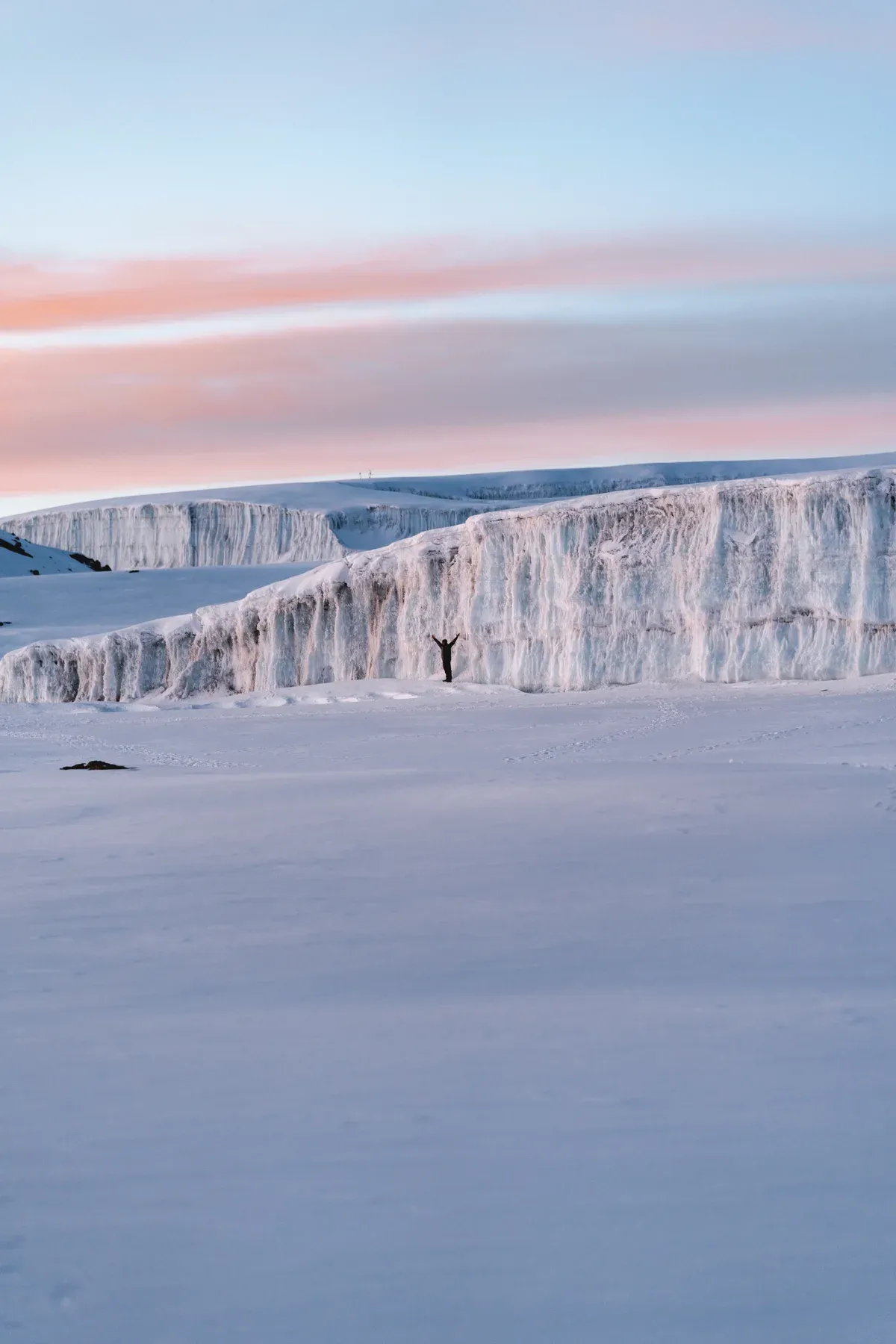
The Furtwängler Glacier in the Kibo crater. Photo: Altezzatravel, CC BY-SA 4.0, via Wikimedia Commons
The Shrinking Ice
The height figures may be stable, but the white cap on top is not.
How Much Ice Is Left
Summit ice covered about 20 km2 (7.7 sq mi) in the late 1880s according to Wikipedia. The Cryosphere study by Cullen and colleagues reports glacier area falling from 11.40 km2 in 1912 to 1.76 km2 in 2011, a loss of about 85 percent. Wikipedia's own figure for June 2011 is under 1 km2, so the two sources disagree on the 2011 area even though both agree on the rate of loss. Wikipedia gives average annual ice loss of 1.1 percent from 1912 to 1953, 1.4 percent from 1953 to 1989 and 2.5 percent from 1989 to 2007, and says nearly 40 percent of the ice present in 2000 had gone by 2011.
The named summit glaciers include Credner, Furtwangler and Rebmann. The Northern Ice Field, the largest remaining ice body, covered 0.95 km2 in 2007 and had split in two by 2011 after thinning by an average of 1.9 m between 2000 and 2007. Furtwängler Glacier covered 113,000 m2 in 1976, about 60,000 m2 in 2000 and only 11,000 m2 in 2018. It was 6 m thick in 2006, and a hole found that year reached bedrock and split it in two by 2007.
The projections are blunt. Cullen and colleagues project the western slope ice gone before 2020, the plateau and southern remnants most likely gone by 2040 and no ice after 2060. Wikipedia makes the same projection in its own words. Alpinist reports glaciers projected to disappear by 2033, a more aggressive date than the peer-reviewed studies, so the range of published dates runs from 2033 to 2060. During the Last Glacial Maximum a continuous ice cap of about 400 km2 reached down to 3,200 m, so what remains now is a small remnant of a much larger cap.
- 20 km2 (7.7 sq mi) of ice in the late 1880s.
- 1.76 km2 in 2011 per the Cullen study, under 1 km2 per Wikipedia.
- Most summit ice projected gone by 2040, all of it after 2060.
Sources: The Cryosphere (Cullen et al.), Wikipedia
Using the Height Figures Well
Do
- Do use 5,895 m (19,341 ft) as your working figure because it is the TANAPA and UNESCO number from the 1952 survey and the one your certificate will carry.
- Do plan your itinerary around the camp heights, because sleeping at 3,900 to 4,700 m across more nights is what helps your body handle the summit push from 4,640 m Barafu or 4,730 m Kibo Hut.
- Do book insurance that covers trekking up to 6,000 m, because a policy capped below 5,895 m will not cover the summit day.
- Do expect summit temperatures of -5 to -20 °C per Footslopes Tours, and pack for them, because the summit area averages about -7 °C.
- Do treat gate and camp altitudes as approximate, since operators disagree on the height of the same camp.
Don't
- Don't confuse Kilimanjaro with its cones, because Mawenzi at 5,149 m and Shira at 4,005 m are separate summits and only Kibo carries the 5,895 m peak.
- Don't book any itinerary using the Western Breach, because Wikipedia says it has been closed since 20 January 2024.
- Don't quote a precise camp elevation from one operator as fact, because Barranco is 3,976 m on Wikipedia, 3,960 m in the Altezza listing and 3,900 m with Nafika Tours.
- Don't assume the ice you see in photos will still be there for your trip, because the projections run from 2033 to 2060 for total disappearance and Furtwängler was down to 11,000 m2 in 2018.
Mount Kilimanjaro Height Questions
How tall is Mount Kilimanjaro in feet?
5,895 m equals 19,341 ft, which is the figure TANAPA and UNESCO use from the 1952 British survey. Kilimanjaro also has a topographic prominence of 5,895 m, so its prominence in feet matches its height in feet. The routes page for the Lemosho Route 7 Days lists the same maximum altitude.
How high is Kilimanjaro compared with other peaks?
Wikipedia describes Kilimanjaro as the highest mountain in Africa, and it is one of the Seven Summits, the highest peak on each continent. Its prominence of 5,895 m and isolation of 5,510 km are both ranked 4th in the world. Each of these routes on Kilimanjaro tours reaches the same summit.
How high is Stella Point compared with Uhuru Peak?
Stella Point is given as 5,756 m (18,885 ft) by Follow Alice and Nafika Tours, though Follow Alice's own schedule says 5,739 m, and Uhuru Peak is 5,895 m. The rim walk between them takes about 30 to 60 minutes per Footslopes Tours, or about one hour per Nafika Tours. The night climb to reach it is described on the Uhuru Peak page.
How high is Gilman's Point on the Marangu route?
Wikipedia gives Gilman's Point as 5,681 m (18,638 ft). One climb log says 5,685 m and one Zara Tours listing says 5,861 m, which looks like a transposition, so 5,681 m is the figure to use. The Marangu huts below it are covered in the Marangu Route 5 Days listing.
How high do you sleep on a Kilimanjaro climb?
It depends on the route. Marangu sleeps in huts at 2,743 m, 3,760 m and 4,730 m. Machame and Lemosho camp at about 3,900 to 3,976 m at Barranco and 4,640 m at Barafu, with Kosovo Camp at about 4,800 to 4,870 m on some itineraries. Longer schedules add nights on the mountain, and the 8-day Lemosho Route 8 Days adds an acclimatisation day.
How high does the ice reach on Kilimanjaro?
Wikipedia lists an arctic summit zone of 5,000 to 5,895 m for the park. It once reached down to 3,200 m during the Last Glacial Maximum. The northern and southern remnants are projected mostly gone by 2040, so see the summit figures in context before you climb Mount Kilimanjaro.